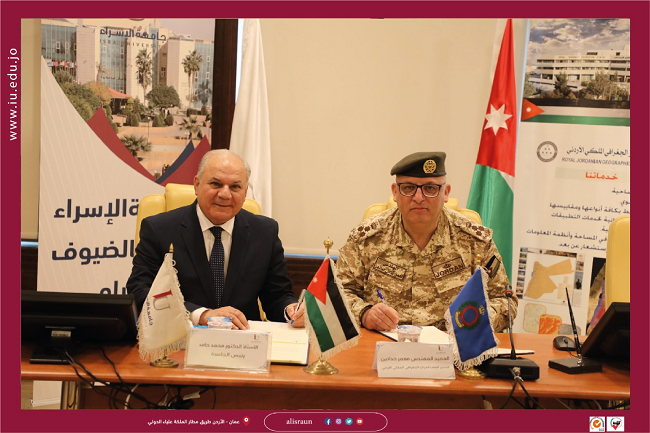
Isra University and the Royal Geographical Centre signed a memorandum of understanding to confer partnership and build bridges of cooperation between the two parties to keep pace with technological development in geographic information systems. The MOU included holding joint training courses in advanced geographic information systems, spatial analysis of geographical data, three-dimensional analysis of geographical data, building geographical databases, analysing road networks and publishing maps on the web. Haddadin stressed that the centre is working hard to provide the Kingdom with all forms of support and expertise and train technicians in the field of surveying sciences, maps, geographic information systems and remote sensing techniques, to help in issues and events of interest to the Kingdom and achieve the public interest, as the centre puts all its capabilities to various national institutions, whether governmental or private. He pointed out the importance of partnership with the private educational sector through the exchange of experiences, and the conclusion of such agreements and MOU, which reflect positively on both parties and the employment of information and knowledge. His Excellency Prof. Mohamed Hamed, President of the University, stressed that the memorandum comes from the university's keenness to support and consolidate the existing strategic partnership between the university and national institutions, whether the public or private sector. He added that the centre, under its management, was able to open up and increase the volume of academic and training cooperation at all levels to develop methods of education, training and dissemination of knowledge to contribute to the service of public and private institutions in the Kingdom, and to qualify and empower university students and refine their skills and abilities by providing them with joint training courses and diplomas between the two parties.